A hurricane satellite image

The Atlantic Hurricane Season begins June 1 and ends November 30. 
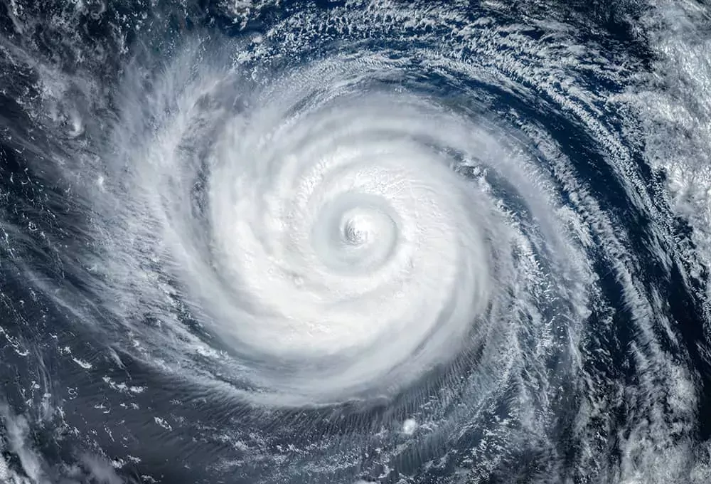
A hurricane is a type of tropical cyclone, which is a generic term for a low-pressure system that generally forms in the tropics. The cyclone is accompanied by thunderstorms and, in the Northern Hemisphere, a counterclockwise circulation of winds near the earth's surface. 

 Tropical cyclones are classified as follows:

  • Tropical Depression: A tropical cyclone with maximum sustained winds of 38 mph or less.
  • Tropical Storm: A tropical cyclone with maximum sustained winds of 39 to 73 mph.
  • Hurricane: A tropical cyclone with maximum sustained winds of 74 mph or higher. 

Hurricanes are categorized according to the strength of their winds using the 1 to 5 rating on the Saffir-Simpson Hurricane Scale. This scale does not take into account other potentially deadly hazards such as storm surge, rainfall flooding, and tornadoes.

Saffir-Simpson Scale for Hurricane Classifications:

Category

Wind Speed

Types of Damage Due to Hurricane Winds

1

74-95 mph

Very dangerous winds will produce some damage: Well-constructed frame homes could have damage to roof, shingles, vinyl siding and gutters. Large branches of trees will snap and shallowly rooted trees may be toppled. Extensive damage to power lines and poles will likely result in power outages that could last a few to several days.

2

96-110 mph

Extremely dangerous winds will cause extensive damage: Well-constructed frame homes could sustain major roof and siding damage. Many shallowly rooted trees will be snapped or uprooted and block numerous roads. Near-total power loss is expected with outages that could last from several days to weeks.

3
(major)

111-129 mph

Devastating damage will occur: Well-built framed homes may incur major damage or removal of roof decking and gable ends. Many trees will be snapped or uprooted, blocking numerous roads. Electricity and water will be unavailable for several days to weeks after the storm passes.

4
(major)

130-156 mph

Catastrophic damage will occur: Well-built framed homes could sustain severe damage with loss of most of the roof structure and/or some exterior walls. Most trees will be snapped or uprooted and power poles downed. Fallen trees and power poles will isolate residential areas. Power outages will last weeks to possibly months. Most of the area will be uninhabitable for weeks or months.

5
(major)

157+ mph

Catastrophic damage will occur: A high percentage of framed homes will be destroyed, with total roof failure and wall collapse. Fallen trees and power poles will isolate residential areas. Power outages will last for weeks to possibly months. Most of the area will be uninhabitable for weeks or months.

 Non-Hurricane Classifications

Tropical Depression

< 38 MPH

Tropical Storm

39-73 MPH

 Source: National Hurricane Center

Below are the 2022 Atlantic hurricane names provided by the National Hurricane Center

  • Alex
  • Bonnie
  • Colin
  • Danielle
  • Earl
  • Fiona
  • Gaston
  • Hermine
  • Ian
  • Julia
  • Karl
  • Lisa
  • Martin
  • Nicole
  • Owen
  • Paula
  • Richard
  • Shary
  • Tobias
  • Virginie
  • Walter

In the event that more than 21 named storms occur in the Atlantic basin in a season, any additional storms will take names from an alternate list approved by the World Meteorological Organization.

The National Hurricane Center uses watches and warnings to inform the public of possible impacts from a storm. Familiarize yourself with the terms used to identify a tropical weather threat.

Tropical Storm Watch

Tropical Storm Warning

A Tropical Storm Watch is issued when Tropical Storm conditions, including winds of 39-73 mph, pose a possible threat to a specified coastal area within 48 hours.

A Tropical Storm Warning is issued when Tropical Storm conditions, including winds of 39-73 mph, are expected in a specified coastal area within 36 hours or less.


Hurricane Watch

Hurricane Warning

A Hurricane Watch is issued when sustained winds of 74 mph or higher are possible within the specified area of the Watch. Because hurricane preparedness activities become difficult once winds reach tropical storm force, the Watch is issued 48 hours in advance of the onset of tropical storm force winds.

A Hurricane Warning is issued when sustained winds of 74 mph or higher are expected somewhere within the specified area of the Warning. Because hurricane preparedness activities become difficult once winds reach tropical storm force, the Warning is issued 36 hours in advance of the onset of tropical storm force winds.


Storm Surge Watch

Storm Surge Warning

The possibility of life-threatening inundation from rising water moving inland from the shoreline somewhere within the specified area, generally within 48 hours, in association with an ongoing or potential tropical cyclone, a subtropical cyclone, or a post-tropical cyclone.

The danger of life-threatening inundation from rising water moving inland from the shoreline somewhere within the specified area, generally within 36 hours, in association with an ongoing or potential tropical cyclone, a subtropical cyclone, or a post-tropical cyclone.


Source: National Weather Service

NOAA Atlantic 2-Day Graphical Tropical Weather Outlook Map