MACARTHUR BOULEVARD RESILIENCE PROJECT

A shoreline breach near Macarthur Blvd in Stuart, Florida.

The Big Picture:

Martin County is a place of great natural beauty, but even here, climate change and some of its effects are having negative impacts on our environment. Similar to coastal communities around the country and the world, Martin County is vulnerable to heavy rainfall and flooding events, rising sea levels and coastal erosion, and increasingly stronger and more damaging storms.

For Martin County to be resilient, we must adapt to changing conditions at the local and global level. This requires long term planning and an investment of time and resources to reduce Martin County’s vulnerability and ensure we can handle future stresses to our fragile coastal community and infrastructure.

The Issue at Hand:

MacArthur Boulevard and Bathtub Beach are vulnerable to rising seas and stronger storms. Each year, frequently aligned with nor'easter storms, repeated and excessive erosion occurs along our barrier islands, and especially at Bathtub Reef Beach. This is only made worse with rising sea levels.

Bathtub Beach's submerged limestone reef can act as a natural breakwater when seas are relatively calm. However, when water levels are elevated during severe storms, this defense system isn’t effective. This process is amplified during high tides.

Large waves crash on the beach, erode the dunes, and leave no buffer between the volatile northeast seas and county infrastructure such as sidewalks, walkways, parking lot, roadway and utilities. Severe erosion has resulted in the protective dune system's total loss on many occasions.

MacArthur Boulevard, the road leading to Bathtub Reef Beach, is at high risk for road failure during these weather events. Whenever a major Atlantic storm erodes the beach and dune protecting Bathtub Beach Park, Martin County conducts emergency sand placement to prevent a complete failure of the roadway and loss of emergency services access and park amenities.

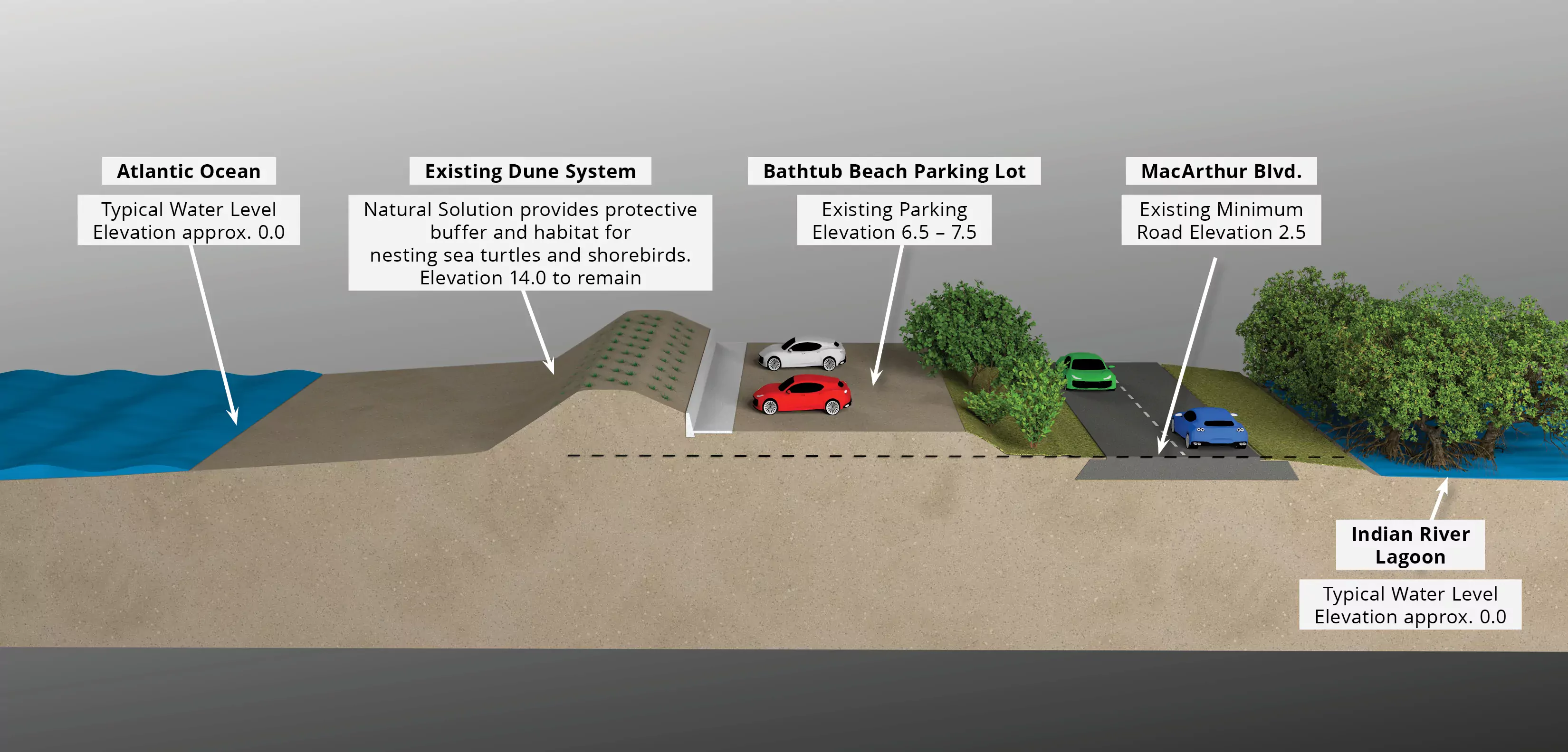
Current Road Elevation during Normal Conditions:

MacArthur Blvd

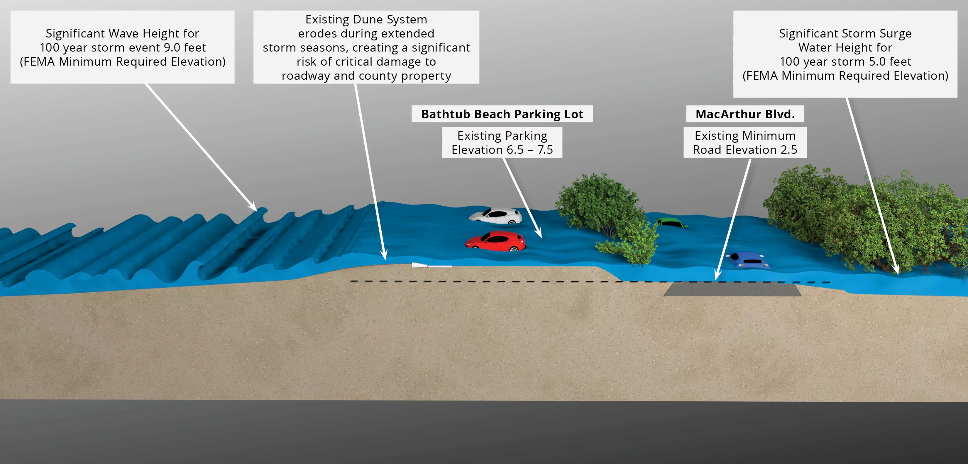
Current Shoreline during Sustained Storm Conditions:

Macarthur Blvd

Project Overview

A Better Way: The MacArthur Boulevard Resilience Project

There is a better way — better for residents and property owners, better for beach-goers, and better for our tax dollars. The goal of the MacArthur Boulevard Resilience Project is to stabilize the shoreline during extreme storm conditions, protect the public beach parking lot and road, and eliminate the need for costly and recurring emergency sand trucking activities.

The project is an opportunity to make the section of roadway at the entrance to Bathtub Reef Beach more resilient while maintaining the integrity and beauty of one of Martin County’s most beloved beaches.

How It Works:

The project targets the weak points of the road near Bathtub Reef Beach and “hardens” it in two phases: shoreline stabilization and roadway elevation. Simply put, here’s what’s going to happen:

Phase 1: Shoreline Stabilization

Build a barrier underneath the dunes just east of the parking lot of Bathtub Reef Beach to defend them during significant wave action.  Essentially, a seawall will be constructed and buried UNDER the dune line. This seawall will hold the line when storms have removed the sand from the beach and dune, keeping water and sand from overwhelming the beach parking lot, flooding MacArthur Boulevard, and damaging utilities that serve the area.

Unlike a typical seawall, however, this barrier WILL NOT BE VISIBLE to beach-goers under normal conditions. It will help to protect the public beach parking lot, roadway and utilities but won’t be seen from either the beach or the road except when major storms have eroded the entire beach and dune. Normal beach restoration will take place, as happens now, during periods of calm weather outside of turtle nesting season.

Phase 2: Roadway Elevation

The project will raise the roadbed in this vulnerable section of MacArthur Boulevard – between Bathtub Beach and Sailfish Point – to prevent its loss due to storms. This 1,100-foot section of roadway along MacArthur Boulevard has a current elevation of 2.5 feet, is vulnerable to flooding, and doesn’t meet FEMA's minimal elevation guidelines.

Through this project, the roadway will gradually be raised with successive layers of paving material (macadam), until it is 5.25 feet above sea level. The sidewalk and parking lot will remain, and new Stormwater Quality Retention ponds will be created for stormwater treatment. 

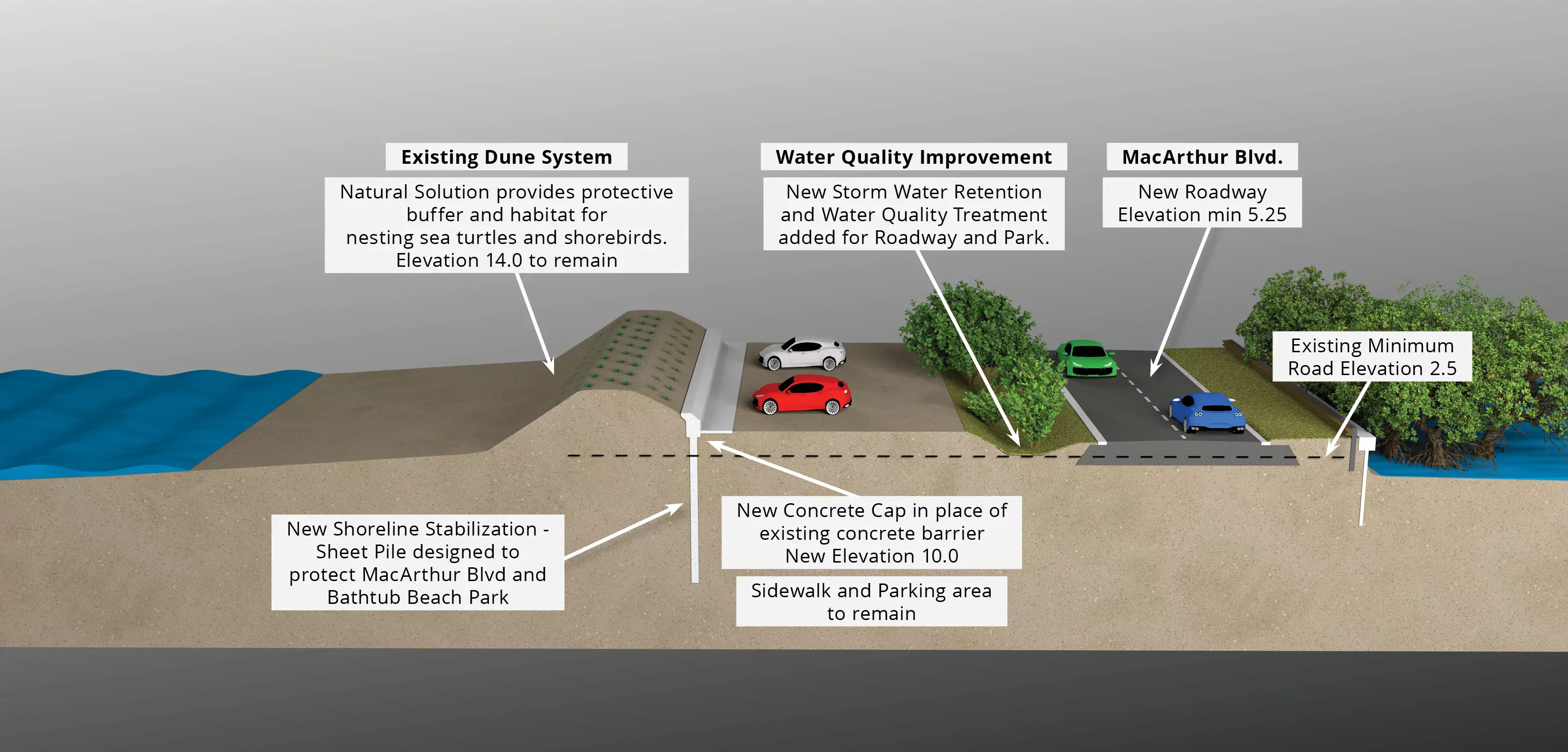
A Protected Solution for MacArthur Boulevard:

Macarthur Blvd

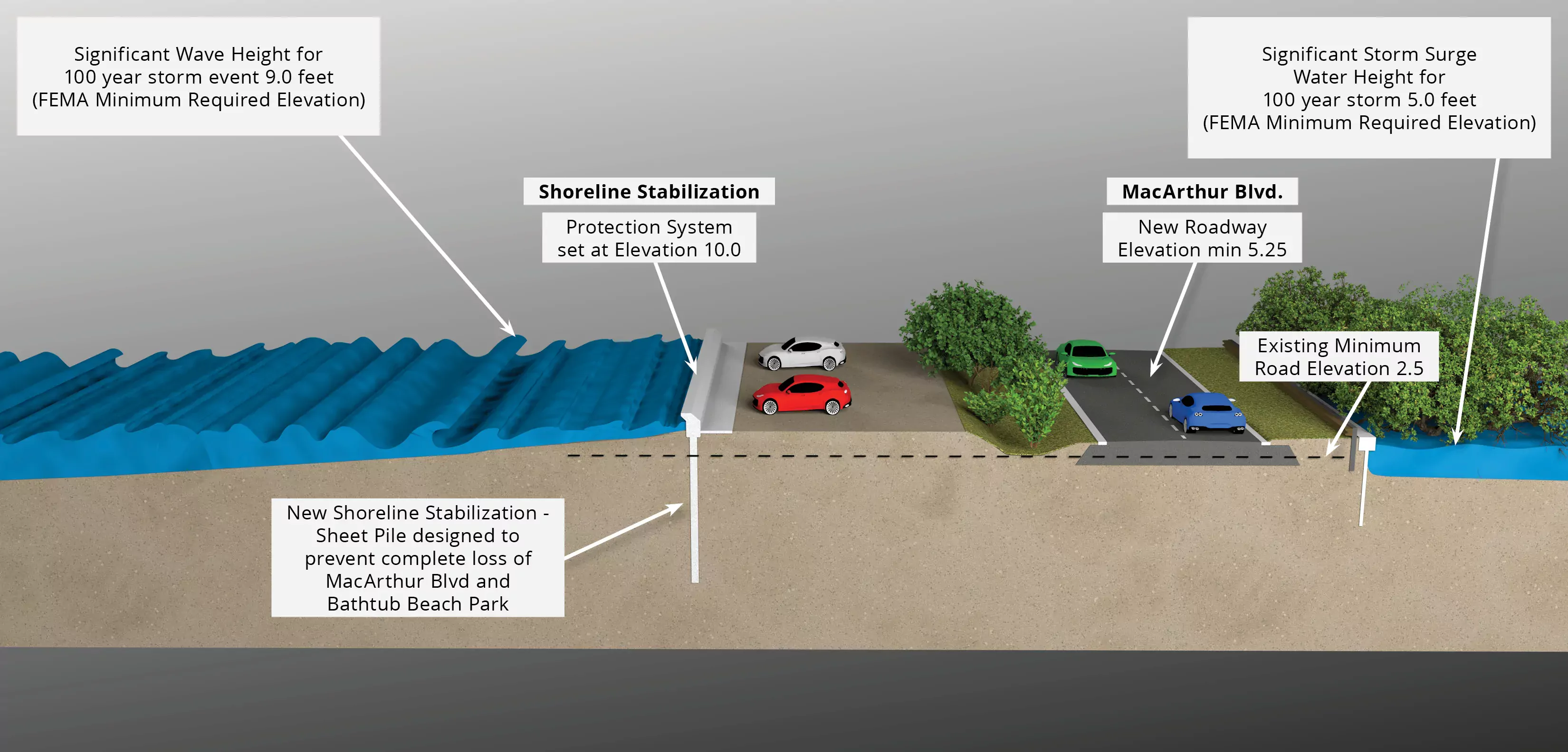
A more Resilient Road during Sustained Storm Conditions:

Macarthur Blvd